
Lindenhurst ZIP Code Coverage
Official research verified one postal code for Lindenhurst: 11757. The Town Historian’s guide identifies Lindenhurst post-office service for both the Village and North Lindenhurst. That makes the service area larger than the incorporated Village. The County ZIP map is useful for orientation, but it was revised in 2013 and says it is not for surveying. It should not settle a boundary question by itself.
| ZIP | Areas Covered | Post Office | Notes |
|---|---|---|---|
| 11757 | Lindenhurst postal city; Town guide identifies service for the Village and North Lindenhurst | Lindenhurst Post Office, 65 E Hoffman Ave, Lindenhurst, NY 11757-5071 | Postal geography is not the Village boundary; office hours should be checked live |
No adjacent service area, ZIP split, historical realignment, unique-institution ZIP, or ZIP-specific registration table was verified in the source set. Keeping the table to the single supported code prevents a mailing label from becoming an unsupported municipal claim.
Verify 11757 With the Post Office
The USPS Lindenhurst Post Office location record identifies the office at 65 E Hoffman Avenue and lists the 11757-5071 delivery address. Research captured hours as Monday through Friday, 9 a.m. to 5 p.m., and Saturday, 9 a.m. to 1 p.m. Hours are changeable operational details, so confirm them with USPS before a visit.
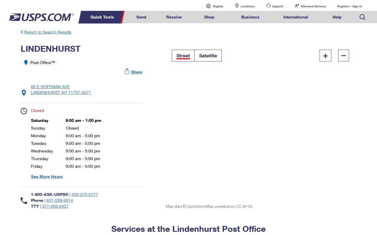
The office listing supports a postal location and delivery label. It does not establish a person’s residence, ownership, or the exact line of the incorporated Village. For an address near a border, preserve the USPS result alongside a Town or County parcel reference and the Village’s own boundary information.
Lindenhurst USPS Lookup Fields
The USPS ZIP Code Lookup offers three relevant routes: By Address, By City and State, and Cities by ZIP. Address mode is the best choice when a full street address is known. City and State can help find postal names, while Cities by ZIP starts with the code. USPS cautions that a result does not confirm a particular person or business at the address.
| Field or mode | Type | Required | Options or format notes |
|---|---|---|---|
| Street Address | Text | Required in By Address | Enter the delivery street and number. |
| Company | Text | Optional | Use only when it is part of the mailing address. |
| Apt/Suite/Other | Text | Optional | Add the unit detail when applicable. |
| City and State | Text/select | Required in City and State mode | Used to return postal matches for that place. |
| ZIP | Text | Required in Cities by ZIP; optional or returned in address mode | Use the five-digit postal code. |
The lookup can standardize delivery information. It cannot replace the legal description in a deed, the tax-map identifier in a Town record, or a survey-grade municipal boundary determination.
Start With a Full Postal Address
The USPS lookup screen makes the address-first approach visible. Begin with the address as printed on the record, then compare the returned postal form with the address in the deed, directory, or tax record. If the original source uses an older street spelling, retain that form in the research note before standardizing it.
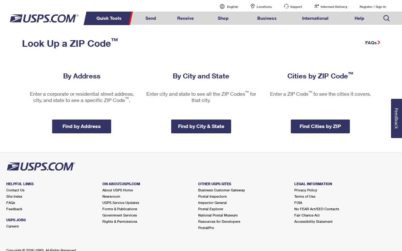
A delivery match is only one layer of identification. A post office can normalize suffixes and mailing format, while County Clerk records use a legal description and the Town uses parcel identifiers. Keeping both forms prevents a clean USPS result from hiding a historical or jurisdictional mismatch. Record the lookup date too, since delivery details and hours can change.
Use a Lindenhurst ZIP Code in Records
There is no official ZIP-wide roster of every person or parcel for 11757. The code works as a narrowing field in a few systems, not as a complete list. The Suffolk County Clerk tax-map lookup accepts ZIP along with a house number and street name. The state voter lookup captures ZIP as part of a personal query. Town of Babylon Property Information searches by street, tax-map components, or item number, while the County GIS viewer is map-based.
- Verify the delivery address with USPS and record the returned postal city and code.
- For a parcel, search the Town portal by number and street, district-section-block-lot, or item number. Keep its tax-map value.
- Use the County Clerk tax-map route with house number, street name, and ZIP where an address filter is useful, then review the result as a parcel lead rather than a ZIP-wide export.
- Use the voter tool only for the requesting person’s own registration details, including county, name, date of birth, address, and ZIP. It is not a public street sweep.
- When the ZIP has narrowed the place, use the Lindenhurst address directory to work from the street and parcel evidence.
For any uncertain parcel line, the Suffolk County Real Property Tax Service Agency’s Tax Map Division is the authority for County tax maps. GIS lines are useful context, but the research notes do not treat them as a survey.
ZIP Filters Have Different Limits
A ZIP field means different things in each portal. The County Clerk’s tax-map screen uses it as an address input beside house number and street. The voter lookup uses it within an identity-specific registration query. The Town parcel system does not offer a ZIP-wide mode, and the GIS viewer requires map navigation. A result set should always be read in the context of the form that produced it.
| Local tool | ZIP use | What it can help locate | Key limit |
|---|---|---|---|
| Suffolk County Clerk tax-map lookup | Address input with house number and street | Tax-map result and parcel-related fields | Not a full parcel export for 11757 |
| NYS voter lookup | Part of a personal query | A requesting voter’s registration or poll-site route | Requires identity fields; no bulk public roster |
| Town of Babylon Property Information | No ZIP search mode located | Street, tax-map, or item-number parcel lead | Informational portal, not guaranteed current |
| Suffolk GIS Viewer | Map context rather than a captured ZIP form | Parcel, road, boundary, flood, zoning, or district context | Layer list varies; parcel line is not a survey |
Search design matters because some County Clerk screens report only the first 1,000 or 2,000 results. Narrow by a complete address, a tax-map identifier, an exact or starts-with name, a date range, or a Liber and Page before drawing conclusions from a large result set.
Lindenhurst ZIP Code and Village Lines
11757 is a postal service area, not an incorporated-Village boundary. The Town guide explains why “Lindenhurst” can cover the Village and North Lindenhurst in postal terminology. Historical labels can be wider still: the former “City of Breslau” included places now called Copiague and North Lindenhurst. A 1950 census label, a 1961 telephone entry, a County deed, a Town parcel record, and a Village record may therefore describe different geographic layers.
The Village street list gives a concrete warning: East Drive number 681 is not in the Village. For a location near a line, save four separate values, then ask the proper Town or Village office about jurisdiction. A ZIP label alone cannot answer that question.
- ZIP versus ZIP+4
- The five-digit ZIP identifies the postal delivery area. ZIP+4 adds a more specific delivery segment, such as a block, building, or unit grouping.
- PO-box ZIP
- A code used for post-office boxes rather than a geographic delivery area. No Lindenhurst PO-box-only code was verified in the research.
- Unique ZIP
- A code assigned to one institution or large recipient. No such Lindenhurst code was verified in the research.
- Carrier route
- A mail-delivery route used by USPS. It is a delivery concept, not a municipal or parcel boundary.
Compare Lindenhurst Address Types
Postal, parcel, and historical sources each describe a different kind of address. Recording them in separate columns helps prevent an old directory entry from being mistaken for current parcel data. The original form should be preserved first. A normalized version can be added after the source date and jurisdiction have been checked.
| Situs | The physical parcel location, commonly found in GIS, assessor, tax-map, and deed material. |
|---|---|
| Mailing | The address used for tax or official mail. It may be outside the local area. |
| Postal | The USPS delivery city and ZIP label shown on an envelope or lookup result. |
| Legal description | The lot, block, metes-and-bounds, or tax-map description carried in deeds and County records. |
| Historical listing | A dated directory, census, or newspaper address that identifies a listing at that time. |
A tax-map or legal description can remain the continuity key when a street address changes. Conversely, a postal label can stay familiar even though its municipal meaning is broader than the Village. Those are different facts and should not be collapsed into one address field.
Lindenhurst Postal Context in 2025
The Census QuickFacts snapshot for Lindenhurst village reported a July 1, 2025 population estimate of 27,258 and land area of 3.75 square miles. That compact setting helps explain why a street can approach a municipal or postal boundary quickly. The figures describe the Village, not a count of people inside a postal service area.
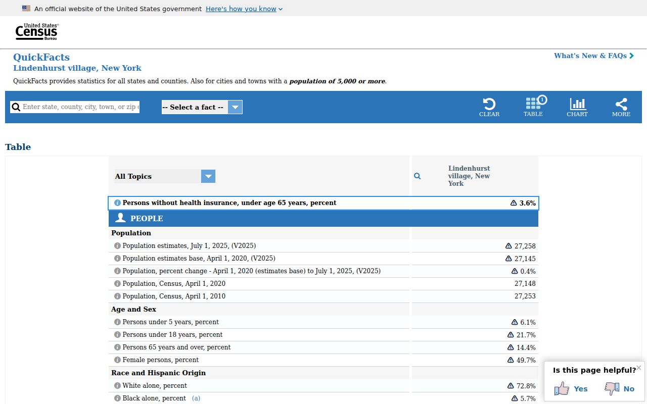
MYTH: A code on an envelope identifies the same geography as the Village. Postal service, census place, Town assessment, County land records, and Village administration serve different purposes. Check the municipality first, then use the tax map or source date to decide which record custodian has the relevant information.